Coastal communities and critical habitats are at increased risk due to impacts from sea-level rise (SLR) and storm events. Managing for SLR and extreme weather conditions in a changing climate is a growing concern. In New England, storm events with strong winds and heavy precipitation (commonly called nor’easters) are the most common coast-shaping storms, followed by hurricanes.
While it is recognized that storm events are increasing in frequency and intensity due to climate change, there is limited information on how the impacts to coastal environments may be amplified as a result, especially in combination with SLR. Additionally, there is limited high resolution, site-specific information on current and future predicted impacts from nor’easters and hurricanes to inform coastal management decisions. These information gaps inhibit our ability to properly plan for the future and is likely to lead to under-informed and ineffective adaptation measures within both natural and built environments. The place-based information generated from this study will promote a fully informed and wise expenditure of resources to improve coastal resilience and protect communities (people, infrastructure) and their ecosystems (habitats, resources, services).
Goal
The overarching goal of this four-year project is to inform and improve management and resilience in New England coastal areas covering five National Park Service (NPS) units, two National Wildlife Refuge (NWR) sites and their adjacent communities. The project will engage parks, refuges, local and state governments, and non-profits in a collaborative and iterative process to ensure the results support specific stakeholder management concerns and affect decision making today and in the future. Specific science and outreach goals include:
- Modeling a suite of storm and SLR scenarios to better understand the impacts to the dynamic coastal systems within the study areas. Such impacts include coastal inundation (flooding), geomorphic (landscape) changes (e.g. of the beach, dunes), habitat and ecosystem response (e.g. marsh loss), as well as considerations for buildings and infrastructure.
- Modeling identical scenarios both with and without management actions intended to mitigate coastal impacts to better understand the implications of such actions, e.g. construction of grey infrastructure (seawalls, groins, etc.) and implementation of nature and nature-based features (NNBF). The actions to be modeled will be iteratively and interactively defined in consultation with stakeholders.
- Developing 3D visualizations and webtools with stakeholder input to facilitate discussions and communicate project results.
- Ensuring stakeholders understand how to use project results in their management and planning decisions
Anticipated Outcome
This project will produce relevant critical information for sites across New England co-developed and provided to a broad range of stakeholder groups for use in management and planning decisions. The project will engage managers and staff at parks, refuges, local and state governments, and nonprofits in a collaborative and iterative process to ensure models, results, vulnerability assessments, and accompanying 3D visualizations address local management concerns.
Sites
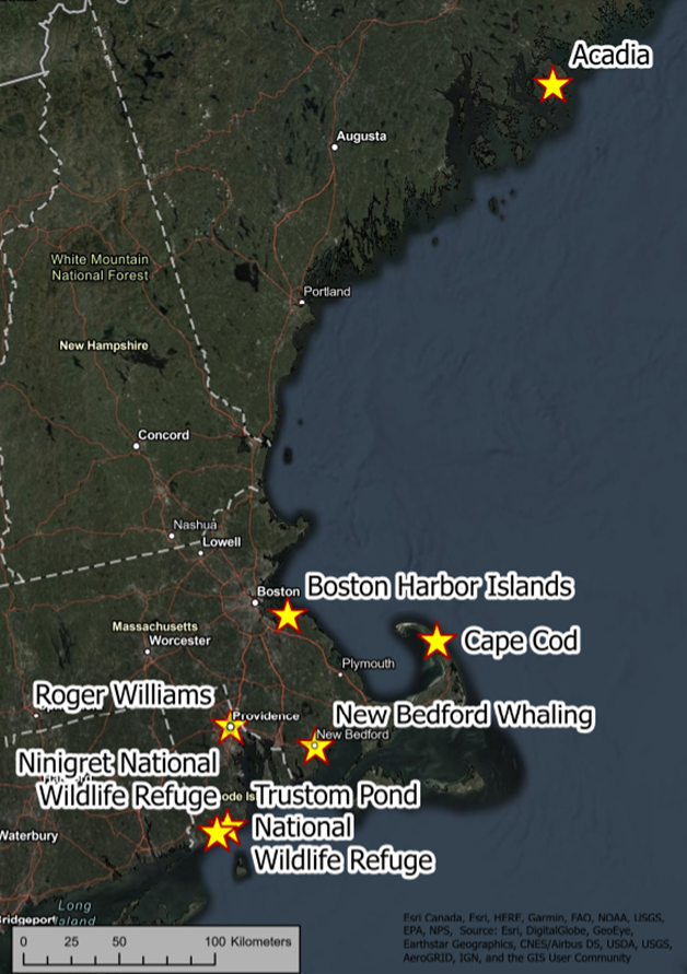
Acadia National Park
Acadia National Park (ACAD) conserves the ecological integrity, cultural history, and scientific values of its rocky headland islands and the Schoodic Peninsula on the coast of Maine. Acadia identified the need for research on nor’easters and climate change through a 2015 scenario planning workshop. Initial conversations with partners and stakeholders indicated storms and rising sea levels threaten Wabanaki cultural sites; beaches and wetlands; infrastructure including roads and bridges; and emergency preparedness. This study will build on a current nor’easter inundation modeling study in ACAD led by the PI Ginis.
Ninigret National Wildlife Refuge and Trustom Pond National Wildlife Refuge
Ninigret National Wildlife Refuge and Trustom Pond National Wildlife Refuge (NITR) are located within the adjacent municipalities of Charlestown and South Kingstown. Beach overwash, erosion, and barrier breaches during extreme storms are part of the natural processes that influence the lagoon system (locally known as salt ponds), periodically flushing the ponds, altering salinity, the shoreline, and sediment supply. Human alterations including lagoon dredging and residential development have influenced the system. Long-term changes in the dynamics due to storm events and SLR are a concern to estuarine habitats (submerged aquatic vegetation, marsh), and oyster aquaculture, a growing part of the RI blue economy, as well as the viability of access to beachfront homes. The lagoon system and adjacent communities are identified as highly vulnerable to storms (RI CRMC, 2018), but with a high capacity to adapt (Grilli et al., 2017). The proposed study will build on existing efforts and focus on the capacity of the site to adapt by exploring anticipated geomorphic and ecosystem changes with and without stakeholder-driven mitigation strategies (e.g., nourishment, marsh restoration, breach response) to support coastal resilience planning/management decisions.
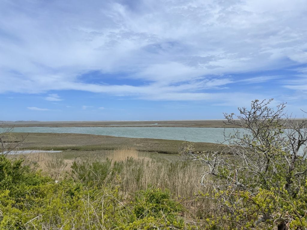
Cape Cod, Massachusetts
The shores of Cape Cod are constantly reshaped through storms and other coastal processes. The area is characterized by eroding bay and ocean shorelines and evolving marsh-lined bays. This proposed study will build on a current nor’easter inundation modeling study in Cape Cod National Seashore (CACO) led by the team lead Isaac Ginis and other research and planning efforts through targeted fieldwork to support storm scenario modeling, to address concerns raised by engaging with partners and stakeholders to identify understand future changes and the effects of potential mitigation strategies. Initial conversations have identified management needs related to planning for inundation of emergency access routes, the local airport, vulnerable historic structures, planned salt marsh restoration, and resiliency efforts.
Boston Harbor, Massachusetts
This study will include Boston Harbor Islands National Recreation Area (BOHA) and gateway communities. BOHA is a partnership park that plays a coordinating role for a range of partners and has been involved in a variety of sea level rise planning efforts, including a current study led by the PI Ginis. This study will leverage BOHA’s relationships to engage stakeholders to understand management needs and communicate project results and products.
Providence, Rhode Island and New Bedford, Massachusetts
Roger Williams National Memorial (ROWI) and New Bedford Whaling National Historical Park (NEBE) are historical sites in urban settings. Both parks and their adjacent communities are located behind protective hurricane barriers that influence the dynamics of coastal flooding from storms and SLR within these areas. This study will build on previous modeling of the Providence area. Based on initial conversations, this study will support ecosystem restoration efforts and infrastructure management, as well as inform parks, cities and property owners, including the New Bedford Whaling Museum and other historical societies, of vulnerabilities, management possibilities, and planning decisions. NEBE and ROWI have strong cultural and historical ties to their respective communities, and they will engage less-represented communities. As part of sharing whaling history at NEBE and RI’s early development at ROWI, these park units have built relationships with diverse communities, including immigrants, people of color, LGBTQ, and regional tribal nations.
Partners
Extension and outreach will be led by the University of Rhode Island (URI) Coastal Resources Center (CRC) and RI Sea Grant. URI and the National Parks Service (NPS) will partner with the parks and refuges to engage key local community stakeholders to ensure the science outcomes are directly relevant to end-user needs. Commitments are in place to leverage the established relationships each park or refuge has with local partners. The project will engage a larger group of organizations through a regional Management Transition Advisory Group (MTAG) with representatives from each park and refuge, as well as the following local partners: Friends of Acadia, ME; Boston Harbor Now, MA; the Town of Eastham representing an inter-municipal shoreline management partnership of the Towns of Eastham, Wellfleet, Truro, and Provincetown in Cape Cod, MA; Buzzards Bay Coalition, MA; Narragansett Bay Estuary Program, RI; the Town of Charlestown, RI. Additionally, the team will leverage NOAA Sea Grant resources and/or ongoing local activities as appropriate to advance community resilience and invite staff to participate as appropriate.
Funding
Funding for this project is provided by NOAA’s National Centers for Coastal Ocean Science (NCCOS), the Effects of Sea Level Rise (ESLR) Program. The ESLR Program awarded $4.6 million in fiscal year 2021 to fund five new and eight continuing research projects that will inform communities on how to best address sea level rise affecting coastal ecosystems, communities, infrastructure, and surface transportation. This project was awarded $1.5 million over four years (FY21-FY25).
The project is led by Dr. Isaac Ginis of the University of Rhode Island (URI) with URI co-partners John Patrick Walsh, Stephan Grilli, Pamela Rubinoff, Annette Grilli, and Peter Stempel of Penn State University. Collaborating participants include the Schoodic Institute and the U.S. National Park Service. This project is part of the NCCOS Effects of Sea Level Rise Program (ESLR) Program.
Have any questions? Contact Isaac Ginis.