
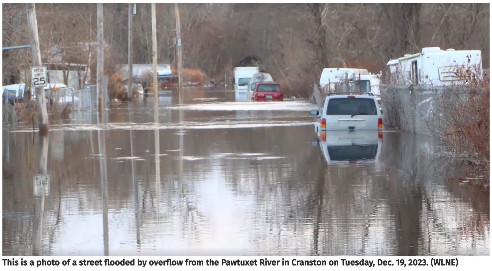
In March 2010, a massive record-breaking rainfall event caused unprecedented flooding across Southern New England states including RI. “In addition to average rainfall, both historical data and climate models show that frequency and intensity of extreme rainfall events are increasing in Rhode Island, and the US northeast, in general,” said Associate Professor of Ocean Engineering Reza Hashemi. “Events like that reflect the impact of climate change on extreme rainfall events. It also tells us that flood zone maps that are prepared based on the past data will also be affected by future changes in rainfall intensity.”
To research and communicate vital information about inland and coastal flooding in Rhode Island, the Department of Homeland Security (DHS) and the Federal Emergency Management Agency (FEMA) have awarded nearly $500,000 to a URI team to develop a Seamless Flood Risk Mapping Tool. The host organization of this project is RIEMA (Rhode Island Emergency Management Agency) which works directly with FEMA. This study will focus on Rhode Island’s coastal and inland flooding hazards in a changing climate, and the extension of the STORMTOOLS initiative using FEMA maps and hydrological/hydraulic modeling. The three-year project will be led by Reza Hashemi and with collaborations from Malcolm Spaulding and Chris Baxter, Thais Fournier, Chris Damon, and PhD student Arash Rafiee.
The project aims to create flood risk maps for inland areas of the state, taking into account changes in extreme precipitation, and seamlessly integrate these maps with existing coastal flood maps. “This project will create one seamless mapping system that covers the entire state and allows consistent permitting guidelines for all state agencies and ultimately the communities that are affected by the impacts of climate change on flooding,” Hashemi said.
The maps will allow communities to access information about flooding generated by rain as well as by coastal storms, thus providing an information tool whereby individuals could go online or use the tool and measure flood risk in particular areas. “There is a relatively good amount of information regarding the effect of sea level rise on coastal flooding through STORMTOOLS” Hashemi said, “but this study also looks at the changes in precipitation and its projected changes.”
The team has plans to work with a variety of agencies and communities to maximize the impact. “We are not just going to do it by ourselves,” said Hashemi. “We are doing it by engaging with all stakeholders. We have been working with all agencies in Rhode Island and town planners and municipalities. We are going to have stakeholder meetings. The Coastal Resources Center is going to be engaging communities as we are developing this tool so they could use it.”
Story by Hugh Markey