The infamous sinking of the Titanic was an international disaster that heightened global awareness to the threat of icebergs. But despite better engineered vessels with detection and positioning technologies over the last hundred years later, icebergs remain a serious marine hazard.
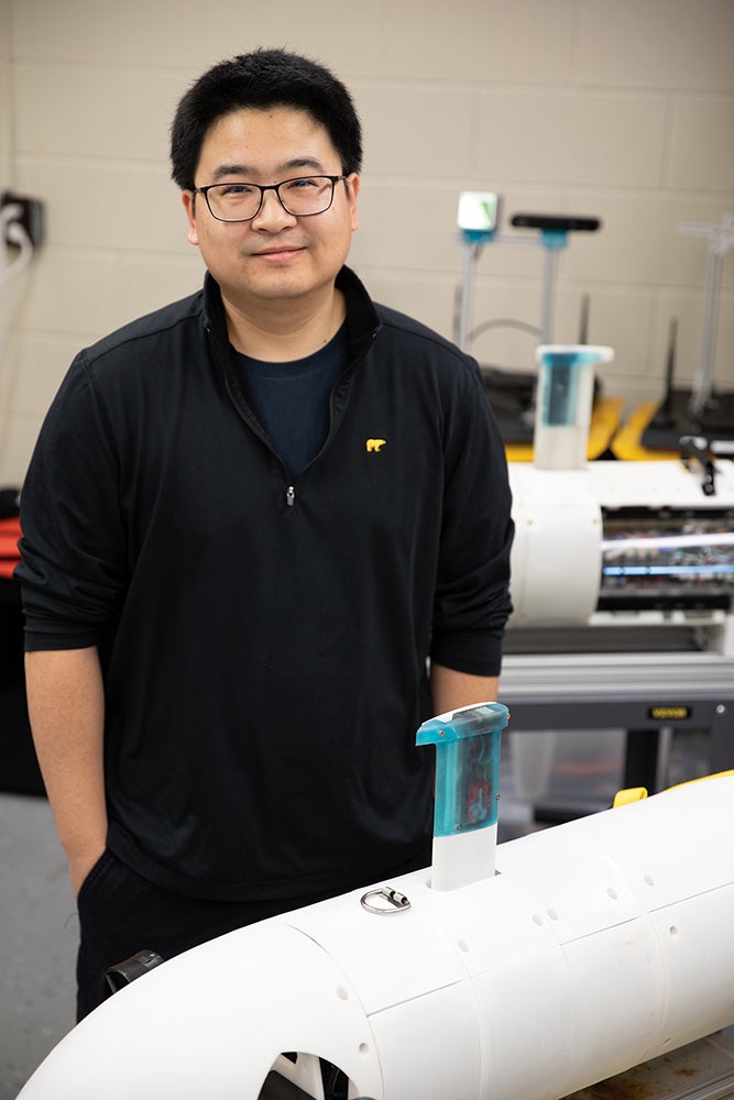
“We still struggle to predict the behaviors of these massive blocks of ice as they move and melt in warmer waters,” says Mingxi Zhou, an ocean engineer and assistant professor at the University of Rhode Island’s (URI) Graduate School of Oceanography, who has been working on applications of various unmanned robotic platforms for mapping icebergs.
According to the International Ice Patrol, which was formed in response to the Titanic tragedy, icebergs remain dangerous because they are mobile and drift in the open ocean, and can still be hidden, even from radar, in high wave or low light conditions.
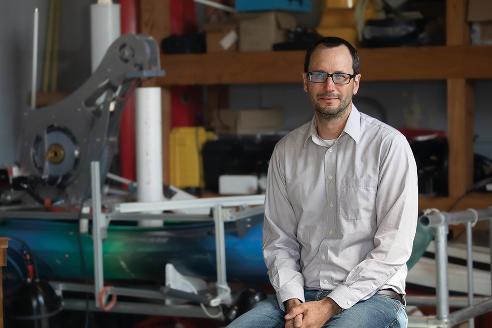
As part of a $1.5 million award from the National Science Foundation, Zhou is working with URI Oceanography Professor Chris Roman and URI alumnus Kris Krasnosky at the University of South Florida to develop a multi-platform robotic system that can more accurately map drifting icebergs and measure surrounding water properties. The goal is not only to better mitigate risks from icebergs but to also predict potential environmental changes, such as sea level rise.
“The major impacts of icebergs are in the polar regions,” says Zhou. “Some studies suggest that more icebergs will break away from ice shelves as a result of global warming.”
Although icebergs form in both regions by breaking off massive ice sheets and glaciers, there is more attention in the North Atlantic where more commercial shipping occurs. Every year, about 40,000 icebergs ranging in size from a school bus to a small island nation break off from the Greenland glacier, in a process known as “calving.” Only 1-2 percent make it down “iceberg alley” as far as St. John’s, Newfoundland.
Although warming temperatures may prompt icebergs to melt faster, more frequent calving and breaking up of larger icebergs means more likely encounters–especially as shrinking Arctic sea ice opens the region to more commercial shipping. But shipping isn’t the only concern. Offshore oil and wind platforms, their cables and pipelines along the seafloor are also vulnerable to iceberg collisions or grounding.
One of the issues in mitigating these risks, says Zhou, is a lack of comprehensive mapping data for iceberg melting and drifting that causes high uncertainty in models. This challenge exists in part because of limitations with ship-based surveys because ships are required to stay 50 meters away from an iceberg for safety reasons.
Icebergs are one example, but it could also apply to deep space exploration, mapping a comet or a new planet that is rotating and moving at the same time.Mingxi Zhou
“The farther away you are, you’re going to always suffer some range, or some accuracy degradation,” says Roman. “So, it’s just fundamentally easier to get higher resolution if you’re closer. And the only option to get closer is to use robotic tools.”
Satellite observations are also limited to above water and shallow water measurements, which don’t account for the majority of the iceberg that is submerged. In fact, it’s the shape of the iceberg below the surface that is a key factor in management because it affects drifting patterns and melting rates.
“These two common approaches have typically overlooked the iceberg shape and water conditions at greater depth, which lead to a significant underestimation in melting rates,” explains Zhou.
He adds that such approaches also prevent scientists from accurately quantifying freshwater input from melting icebergs. They need this to predict potential impacts to local ecosystems and large-scale ocean processes, such as the current circulation pattern in Atlantic Ocean, and sea level rise.
“When icebergs are drifting around, they bring freshwater from melting, thus impact the local water properties and ecosystems,” Zhou says.
The research team plans to focus on several icebergs to obtain a 3D shape and data on the surrounding water, which will be used to validate iceberg melting models. This research can then be applied to large scaled icebergs observed by satellites to get a clearer picture of the iceberg melting on a global scale.
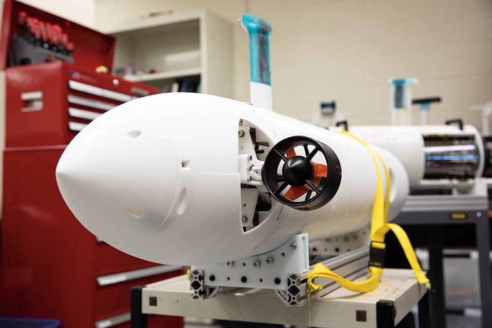
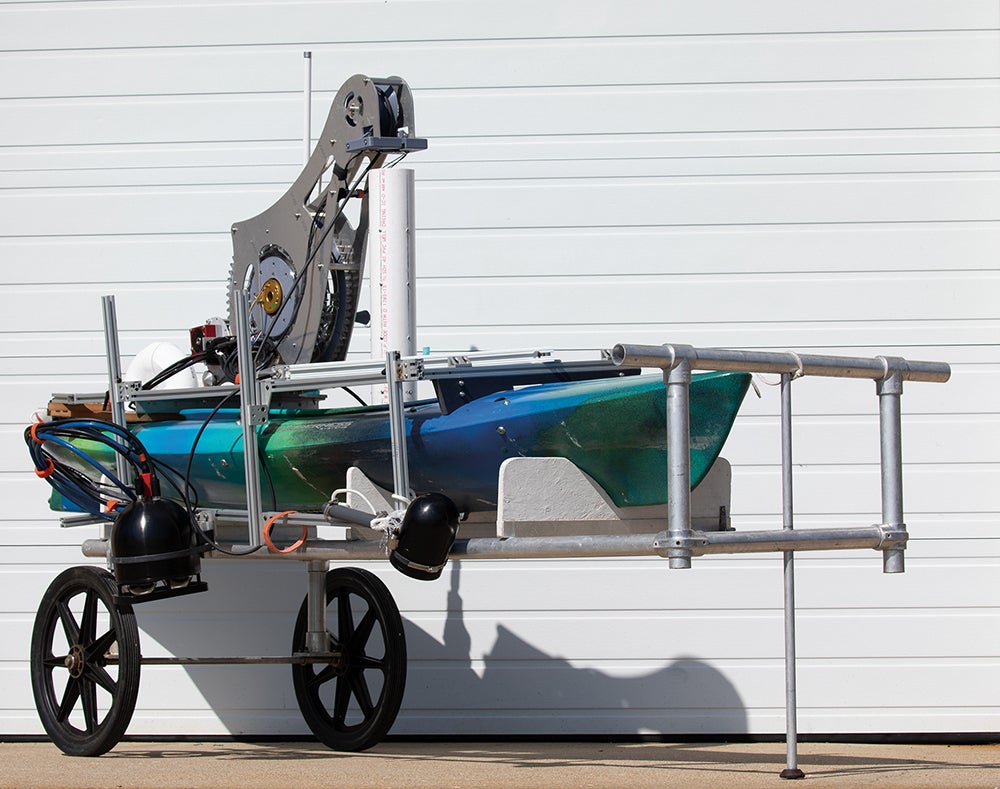
Currently underway is the development of two autonomous vehicles to operate at and below the surface in addition to several underwater profiling floats to map the shape of icebergs and assess the surrounding water column. The team will operate these robotic systems as close as 15 meters to selected icebergs but one of the biggest challenges is coordination of these systems around a moving object.
“The thing that makes this the most different from other projects is that you’re working with a moving reference frame,” says Roman. “Everything has got to be coordinated relative to something that’s both moving and rotating slowly.”
As the URI research team prepares for summer field tests in Narragansett Bay before heading to St. John’s, Newfoundland, for the fieldwork, they will be simulating the vehicles virtually and starting to design the vehicle autonomy algorithms.
“We want to be able to do this entirely in a simulated environment; both the iceberg, the sensors, and the moving vehicles,” explains Roman. “We basically want to do all of the coordination in the simulation because if you can’t do it in a simulation there’s no way it’s going to work in the field.”
Outcomes of this project will be two-fold, possibly extending well beyond icebergs.
“On the iceberg side, we expect to create a multi-day, multiple iceberg shape and water property data set for the scientists to validate and improve their iceberg models,” says Zhou. “On the robotics side, we expect to develop a multi-robot system that could map large scale moving objects. Icebergs are one example, but it could also apply to deep space exploration, mapping a comet or a new planet that is rotating and moving at the same time.”