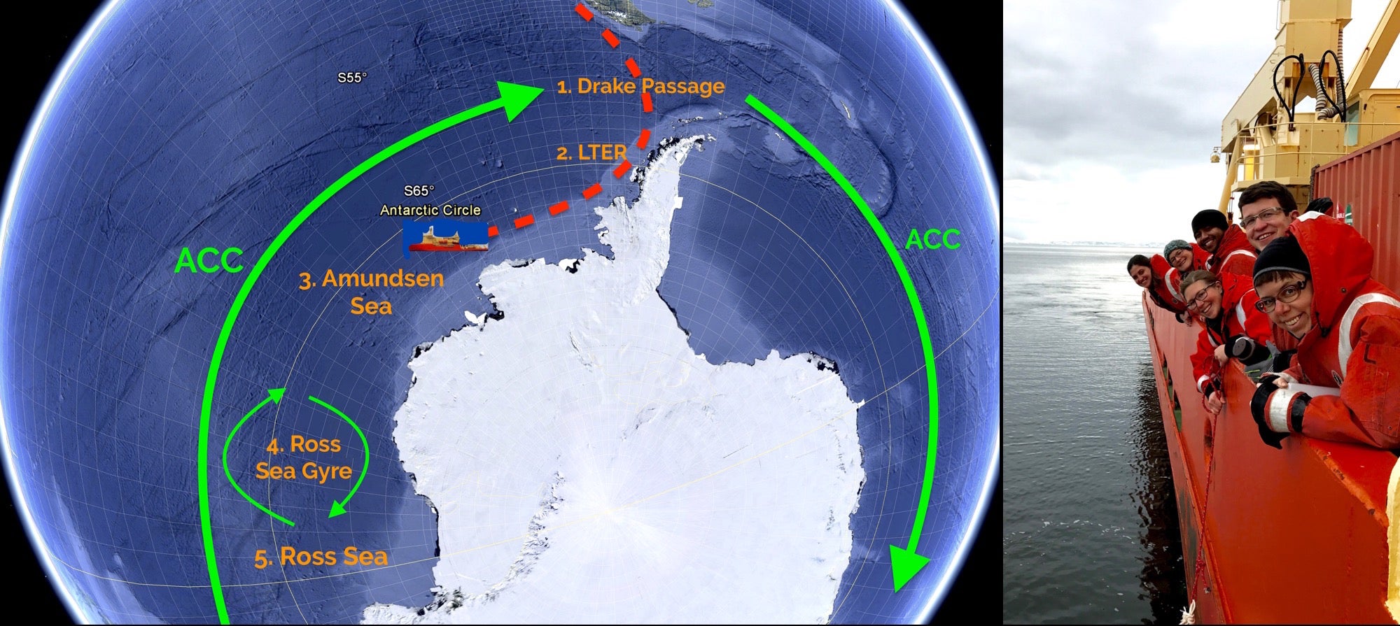
If you’ve been following our journey, you’ve probably noticed that our cruise track has taken us across several lines of longitude and many time zones. In total, we will be setting back our clocks eight times while we traverse the Southern Ocean! Why would we subject ourselves to such chaos? The answer lies in the unique regions that surround Antarctica. Each sea, gyre, or coastal region has different physical properties like ice cover, nutrients, and current speed. Some of our goals include understanding how diatoms cope with each of these environments and learning how they will continue to thrive in the future. Follow along as we explore the Southern Ocean’s unique regions.
1. Drake Passage: The strongest current in the world, the Antarctic Circumpolar Current (ACC) cycles through here and stirs up nutrients that can be used by diatoms for photosynthesis.
2. Palmer Long Term Ecological Research (LTER) grid: This region has been sampled annually since 1991, which will allow us to place our data in a greater context. It’s also located on the coast which has high nutrient input from ice melt. For more information, check out Kerry’s earlier post!
3. Amundsen Sea (where we are now): One of the least studied regions. Iron, a much needed element for phytoplankton growth, is thought to enter the Amundsen Sea through glacial melt and fuel diatom communities.
4. Ross Sea Gyre: This region is thought to be iron-limited, but diatoms continue to exist here due to complex circulation patterns.
5. Ross Sea: One of the most productive regions (lots of photosynthesis occurs here) due to large collections of phytoplankton.
The picture shows our research cruise path (left) and surface water sampling with the Rynearson lab (right). Posted by: Stephanie Anderson