Geospatial technologies are a key resource for a wide range of fields. The skills to harness these technologies are highly sought by a variety of employers including municipal, state, and federal government, academia, businesses, environmental consulting agencies, and the military. The URI Graduate Certificate in Geographic Information Systems and Remote Sensing (GIS/RS) provides students with advanced training in using geospatial technologies and equips them with the tools to solve spatial problems. Course work covers essential concepts and focuses on practical applications relating to environmental issues. Students who complete the program will be able to:
- find existing geospatial datasets from a variety of sources;
- create new datasets through on-screen digitizing or collecting GPS data in the field;
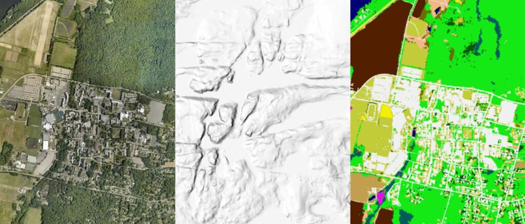
- process and classify satellite and aerial imagery to map features of interest;
- analyze data using advanced workflows in ArcGIS Modelbuilder and Python scripting;
- present data using static maps, interactive web maps, and other web-based tools (e.g. Story Maps, Dashboards, etc.).
Elective courses will provide students with specialized skills in topics such as Python scripting, landscape pattern analysis, marine remote sensing, coastal resilience, and spatial statistics. Students will become proficient with the latest in Esri’s software suite (e.g. ArcGIS Pro, ArcGIS Online) which dominates the geospatial industry. Graduates of the program will be well-positioned to seek a career as a GIS professional or transition into a professional Masters program.
Requirements
The following courses are required:
NRS410 – Fundamentals of GIS (3 cr).
NRS509 – Concepts of GIS and Remote Sensing in Environmental Science (4 cr)
NRS522 – Advanced GIS Analysis of Environmental Data (3 cr)
NRS516 – Remote Sensing in Natural Resources Mapping (3 cr)
or NRS415 Remote Sensing of the Environment (3 cr)
Plus 3 credits from the following elective courses:
NRS 591 – Special Topics (1-3 cr)
NRS528 – Geographical information systems in Python (3 cr)
NRS533 – Landscape Pattern and Change (3 cr)
GEO535 – Geospatial Watershed Modeling (3 cr)
MAF465 – GIS Applications in Coastal and Marine Management (3 cr)
STA515 – Spatial Data Analysis (3 cr)
OCG555 – Modern Oceanographic Imaging and Mapping Techniques (3 cr)
OCG665 – Marine Bio-Optics and Remote Sensing (3 cr)
Admission requirements
Bachelor’s degree from an accredited College or University. International students are required to have an overall TOEFL score of 80 or more AND meet the minimum in each individual area: Reading 20, Writing 22, Listening 17, Speaking 17.
Accelerated Bachelor to Certificate (ABC) Program
Through the ABC program, undergraduate students at the University of Rhode Island can double-count up to three-fourths of the total credits required for the certificate (i.e. 12 credits) toward both the undergraduate degree and the certificate (see Graduate School Manual Appendix K for details). Students accepted into the certificate program are automatically enrolled in the ABC program. Undergraduate students must take 1 additional graduate-level credit (i.e. NRS 591 – Special Problems) after graduation to complete the certificate program.
Masters of Environmental Science and Management Program
This certificate can be counted toward the Masters of Environmental Science and Management Program (MESM).
Application Instructions
Submit an online application through the URI Graduate School.
You will need to provide: (1) college transcripts certifying successful completion of a bachelor’s degree, (2) two letters of recommendation from peers, mentors, or colleagues attesting to your ability to complete graduate-level coursework, and (3) a personal written statement explaining why you are seeking a graduate certificate in GIS/RS. GRE’s are not required.
Applications for Fall semester admission should be completed by 10 August and applications for Spring semester admission should be completed by 1 December.
Cost
Standard URI tuition and fee rates for graduate programs apply for the Certificate in GIS and Remote Sensing.
Once in the program
The Graduate Certificate in GIS and Remote Sensing is treated as full-fledged graduate program of the University of Rhode Island. Students must follow standard graduate school guidelines, policies, and deadlines as they navigate the certificate. Important information resources for new students in the program can be found at:
The URI Graduate School
Grad School Forms
New students should meet with Dr. Jason Parent to develop a Program of Study. The Program of Study lists all the classes the student must take to complete the requirements for the certificate.
In the student’s final semester, a Intent to Graduate form must be completed.
Frequently Asked Questions
- Can credits in this certificate program be double-counted towards a graduate degree?
Yes, as long as you are enrolled in both programs at the same time the courses can be double-counted. - Can I transfer in credits for program courses taken before being admitted to the certificate program?
Yes, you can get credit for program courses taken before being admitted to the program. Students often have completed one or more courses in the program before being admitted. - I am currently a URI graduate student but I already took some of the program courses as an undergraduate student at URI. Can I apply the courses taken as an undergraduate toward the certificate?
No, you cannot count courses from a previously completed degree program toward your certificate. You can work with Dr. Parent to determine if appropriate substitutions can be found for the courses you have already taken. - Can I complete the certificate program as an undergraduate student at URI?
You can complete all but 1-credit of the program as an undergraduate student (and double-count 12-credits towards both your undergraduate and certificate requirements). The graduate school requires that at least 1-credit of the program be taken after you complete your undergraduate degree. You can meet this requirement by taking 1-credit of NRS 591 (Special Topics) in the summer/semester after you graduate. NRS 591 can be taken remotely, if needed. - I am an undergraduate and I already took NRS 409 instead of NRS 509. Do I need to take NRS 509 also?
No, you do not need to retake NRS 509 but you will need to take 1 credit of NRS 591 (Special Topics) to satisfy the NRS 509 requirement. You should take this credit after you finish your undergraduate degree so that it will satisfy the graduate requirement to take at least 1 credit as a post-graduate. NRS 591 can be taken remotely, if needed. - I am a URI undergraduate student and trying to decide between the certificate and the GIS/RS minor. Which should I choose?
Each option has certain advantages depending on your situation.
The certificate is graduate-level and will likely be considered more rigorous by employers. Twelve credits can be double-counted toward both the certificate and your undergraduate program. The graduate certificate can be counted toward the Masters in Environmental Management or BES graduate program. A 3.0 GPA must be maintained for courses in the certificate. To complete the certificate, you need to take and pay for 1 additional credit of NRS 591 after graduation.
The minor can be completed at the same time as your major degree so there is no need to take an additional 1-credit course after graduation. A 2.0 GPA must be maintained for courses in the minor. Only two courses in the minor can be double-counted toward the major. Courses taken for the minor cannot be later applied toward a URI graduate program unless you are in the Accelerated Bachelor’s to Masters program. - I’m a URI PhD student and cannot get credit for 400-level courses. Do I still need to take NRS 410?
NRS 410 should be taken unless you already have extensive GIS experience conducting spatial analyses. NRS 410 provides essential background for the advanced course (NRS 522) – students who do not have this prerequisite tend to have a more difficult time in NRS 522.
To get credit for taking NRS 410, you can arrange to take the course as NRS 591 (Special Topics) with Dr. Parent. You will be placed in the course with the NRS 410 students and get the same experience. NRS 591 will be substituted for NRS 410 in your program of study. - Can the courses in this program be taken online?
The core courses in the program are currently either online and asynchronous or are in-person with a remote attendance option. Remote attendance options for in-person courses are at the discretion of the instructor. Some elective courses may not have a remote attendance option. - When is the best time to start the certificate program?
It is best to start the program in the Fall semester which is when the introductory-level courses are offered. Advanced courses are offered in the Spring semester. - How long does it take to complete the certificate program?
The program requires a minimum of 16 credits. It is possible to complete the program in two semesters if you are enrolled full-time and start in the Fall or summer (NRS 410 is usually offered in the summer).
Contact
For more information, contact Dr. Jason Parent (jason_parent@uri.edu)