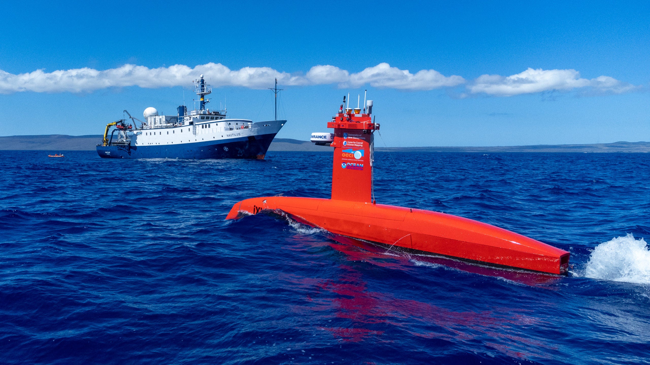
DriX
Larry Mayer (UNH) and Val Schmidt (UNH)
Photo by Ocean Exploration Trust
Overview
In support of OER’s mandate to advance technology for ocean exploration as well as the National Ocean Mapping Exploration and Characterization strategy, OER, through the OECI, has invested in the development of an advanced autonomous surface vessel (DriX) that has significant speed and sea-keeping abilities as well as the ability to map the seafloor and the water column while serving as a critical communication link for collaborative vehicle activities. The DriX was delivered to the OECI in the summer of 2021, put through a series of pier-side sea trials and tests and was shipped and integrated onto the E/V Nautilus in early 2022 for initial integration and sea-trials. In its initial delivery, the DriX was only capable of carrying an EM2040 multibeam sonar with maximum mapping depth limit of 500 m. Understanding OER’s mandate to map in deeper water, UNH, Kongsberg Maritime and iXblue embarked on an effort to see if a deeper water mapping system could possibly be integrated into the OECI DriX. Through the significant design efforts on the part of both Kongsberg and iXblue, a newly developed compact EM712 (40-100kHz) has been developed and, with a newly modified gondola for the DriX, should offer OECI’s DriX the ability to map to water depths beyond 3000m. The development of a “compact EM712” is an important advancement in multibeam sonar technology as it opens up the option for the deployment of deep-water mapping systems on much smaller platforms including other autonomous surface and underwater vehicles. This project, supporting the integration of the compact EM712 and gondola, advancements and integrations will be tested and demonstrated during the E/V Nautilus Shakedown and technology challenge expeditions.
Year 7 Update
DriX Technology Advancement
Val Schmidt, Larry Mayer (UNH)
Overview
In Year 7, DriX-8 returns to UNH’s Marine Autonomy facility after five years of continuous Pacific deployment for invasive maintenance, repair, and installation of new safety and scientific systems — then redeploys to the 2026 Nautilus expedition.