
Michaela Derderian ’19, M.E.S.M. ’24 uses GIS to maintain critical infrastructure records at Providence Water, helping crews and engineers keep Rhode Island’s water system running.
KINGSTON, R.I. – Nov. 9, 2026 – When a Providence Water crew pulls a lead service line out of the ground and replaces it with copper, the job isn’t finished until Michaela Derderian updates the map.
That step is part of Derderian’s role as a GIS specialist at the Providence Water Supply Board, where she maintains the digital record of a system that supplies drinking water to about 60% of Rhode Island. The record includes every water main, valve, hydrant, and service line, along with what each is made of and when it was installed. Engineers, inspectors, and field crews rely on it every day, including during emergencies.
“I really like how with GIS, you can either work really small or really big,” said Derderian, a graduate of URI’s Master of Environmental Science and Management (MESM) program. “You focus on the details of what you want to map out, but it can create a big picture.”
In some ways, cartography is a family tradition. Derderian calls herself a digital cartographer, following in the footsteps of her grandfather, who drew maps by hand at a drafting table in the 1950s and ’60s. “I like to think that his career has moved to the computer,” she said.
Rebuilding the map while everyone used it
Soon after Derderian joined Providence Water in May 2024, she became part of a major transition in how the utility manages its infrastructure records. The six-person GIS team was preparing to move away from ArcMap, software that Esri was retiring. Over the next year, working with Esri partner DCSE, the team rebuilt the utility’s records in ArcGIS Pro and ArcGIS Utility Network, a data model designed specifically for water systems.
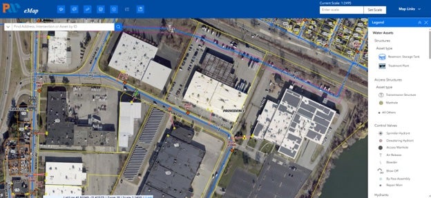
The challenge was that the utility couldn’t simply stop using its maps during the transition. Until the new system was connected to the web map used by field crews, Derderian and her colleagues sent screenshots and custom maps to ensure crews had up-to-date information.
Beyond maintaining the system itself, Derderian’s work involves helping others across the utility understand and use the information GIS provides. She creates maps and works with departments across the utility, including engineering, water quality, and customer service, as well as field crews. Her team also conducts annual training for other departments.
The lead service line replacement program brings many of those groups together, with GIS helping track what’s actually in the ground.
“The fact that it could be interactive can help our engineers or our laborers,” she said. “It could make other people’s jobs easier, make things a little more efficient, and provide a whole new level of information to everyone.”
Finding her focus at URI
Derderian’s path to GIS began at URI, where a senior-year course introduced her to the technology. After graduating in 2019 with a degree in environmental science and management, she worked several jobs during COVID before deciding to pursue GIS through the MESM program.
Living in Massachusetts, she began with URI’s online Graduate Certificate in GIS, then applied those credits toward her MESM degree and returned to Rhode Island for her second year. “I thought I was so underprepared,” she said. “By the end of it, I felt like I could take on the world.”
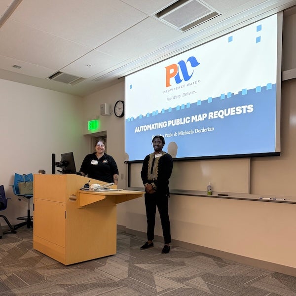
The program also helped her build skills she uses in her work, including interpreting aerial imagery and communicating technical information. For her culminating experience, she helped develop a pilot interactive campus map—an opportunity to think about what users need to see and how best to show it.
Giving back
Rhode Island wasn’t where Derderian grew up, but it has become home. Although she was raised in upstate New York, her father’s family is from Rhode Island, and her family moved to the state while she was an undergraduate at URI.
“URI has given me some of my best friends. MESM has given me a career that I’m really proud of. Rhode Island has given me a sense of community,” she said. “Being able to provide something that, to me, is a right and a necessity, I’m very happy to do it.”
For students considering GIS, Derderian recommends taking at least one or two courses, even if they don’t plan to pursue it as a career. The technology has applications in fields ranging from public health and economics to natural resources and utilities, and employers increasingly value GIS skills. “It’s an important tool and asset to have,” she said.
At Providence Water, Derderian sees that value every day: in the records that help crews locate and replace aging service lines, the information that guides engineers, and the maps that keep a critical utility running.