Survey measurements are taken along the south coast of Rhode Island at seven distinct locations (shown above), ranging from Misquamicut State Beach in the West to Moonstone Beach in the Trustom Pond National Wildlife Refuge in the East.
All of the survey locations are located on sandy barrier beaches, bordered by the Block Island Sound to the south and coastal lagoons, referred to as salt ponds in Rhode Island, to the north. Surveys are generally conducted at low tide in order to maximize the amount of measurable beach.
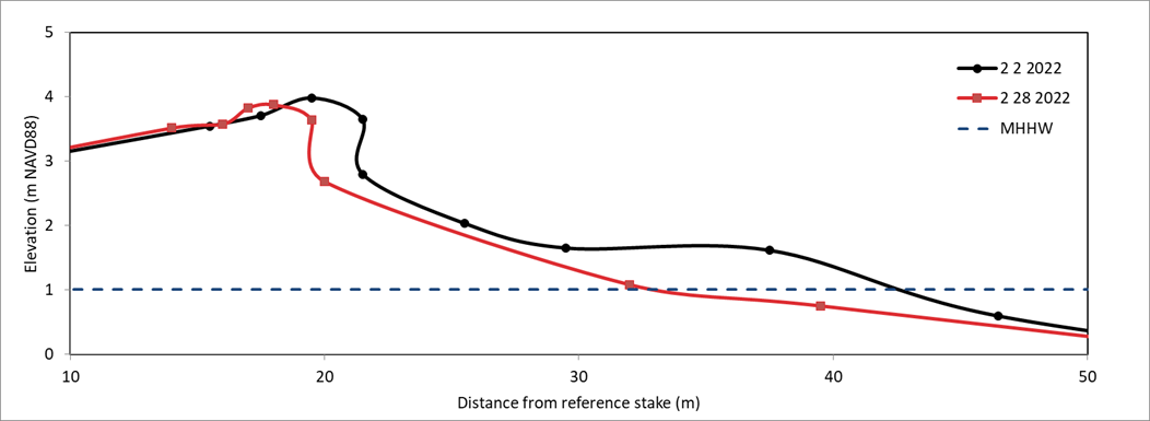
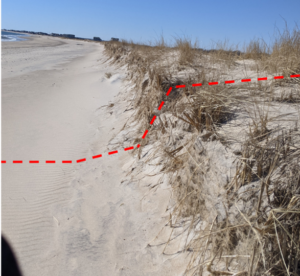
Beach elevation measurements are taken across the width of the beach from the dune to the waterline.
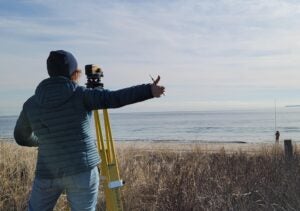
Measurements have historically been taken with a transit instrument and stadia rod with respect to a GPS-referenced point, but the survey will be transferring to a real-time kinemati
c (RTK) GPS system soon. Collected data is then processed to measure how beach erosion and sediment transport dynamics change through time.