The Graduate School of Oceanography’s Narragansett Bay Fish Trawl Survey is an extensive data collection dating back to 1959 when Charles Fish began the survey. The University is pleased to share these data with others in the interest of furthering unbiased fisheries, management and oceanographic research.
We ask that any use of these data properly cite the University of Rhode Island’s involvement in this data collection. Please read our policy letter before using any of the following data.
Data Use Policy LetterSurface and Bottom Environmental Data
Available downloads:
Surface and Bottom Temperature
Fox Island and Whale Rock 1959-2024 (.XLS)Surface and Bottom Conductivity, Salinity, Temperature, and Dissolved Oxygen
Fox Island and Whale Rock 2006-2024 (.XLS)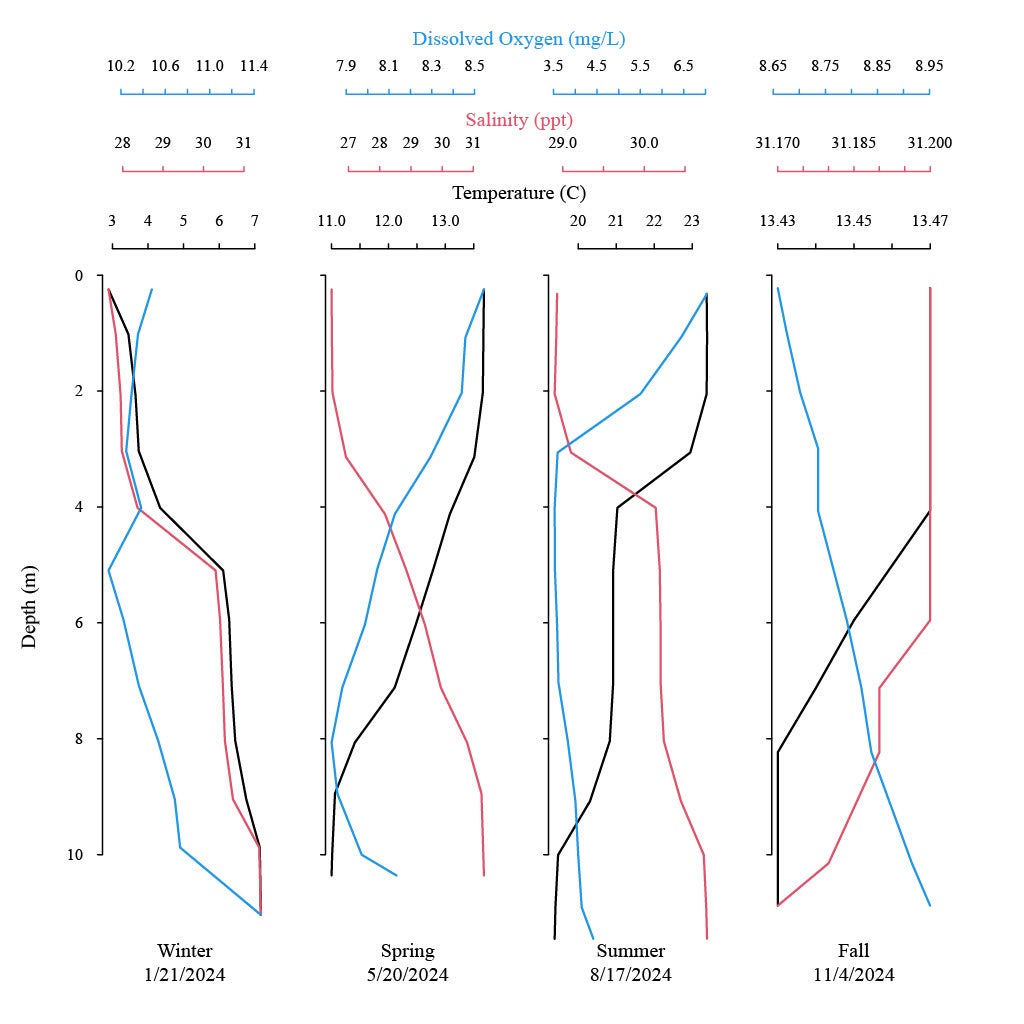
Fish and Invertebrate Catch Data
Available downloads:
Fish and Invertebrate Catch Data 1959-2024 (.xlsx) GSO Fish Trawl Report 2024