URI Graduate School of Oceanography student Jiahang Li and faculty member Dr. Yang Shen are currently off the coast of the Island of Hawaii as part of a “rapid response” to the ongoing eruption of the Kilauea volcano and accompanying earthquakes and tremors. As the pair works with other researchers to deploy instruments on the ocean bottom, Jiahang will provide updates throughout the week-long cruise.
The Big Island of Hawaii slowly revealed itself from the morning mist. After a 24-hour cruise, the R/V KOK reached a test site about 10 miles southwest of the coast of the Island of Hawaii on Sunday morning. There was surprisingly little shipping and boating activity around us, but the gulls kept us company.
During the cruise, Dr. Jackie Caplan-Auerbach from Western Washington University, Dr. Julia K. Morgan from Rice University and Dr. Yang Shen from URI’s Graduate School of Oceanography gave brief lectures about the background of the south flank of Kilauea, its geology structure, historical earthquakes, and current monitoring systems.
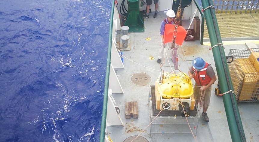
The weather has been in our favor so far, sunny and calm, perfect for working on the deck. As a volunteer, my main job is to assist deployment of ocean bottom seismometers (OBSs) and be on watch for bathymetry mapping when we are not deploying the instruments.
At our first site, we lowered the acoustic transponders, which are used to locate the OBSs once they are sunk to the ocean bottom, to about 1-kilometer depth to test the acoustic signal. After all of the transponders were tested, we sailed out and started to position the OBSs at sites that range from 1,000 to 5,000 meters deep. The first three deployment sites are located at the boundary of the Mauna Loa and Kilauea south flanks, which are relatively far away from the other sites. Overall, four OBSs were deployed in the first two days (July 8th and 9th) and will stay on the ocean bottom for the next two months.
Recovering these seismometers is a time-honored and fascinating process. An OBS is attached to a metal anchor with a burning wire so it can sink all the way to the ocean bottom. For recovery, once an OBS receives an acoustic signal sent from the ship, it will melt the burning wire, drop the anchor and start to rise to the surface. Another planned cruise will collect the OBSs around the middle of September.
The cruise is halfway finished and we are heading east to the most seismically active zone, where we may see lava flowing into the ocean. During the night, we can see the Kilauea volcano glowing about 20 miles away from the ship. I am excited about the chance to get a closer look at this incredible eruption!
